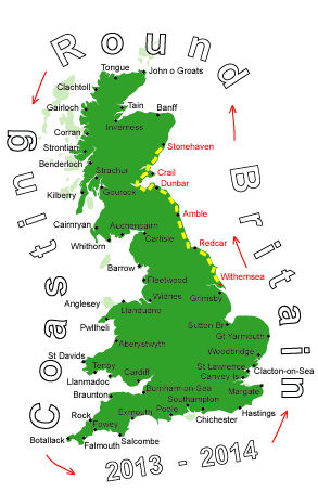
Log No 30. Mon 29th Apr 2013 - Inverbervie to Stonehaven, 11 miles (491 miles walked)

| The coastline north of Inverbervie |
Just in case it was my boots that had caused the pain in my left leg on Friday I decided to walk with the boot laces tied below the last eyelet.
Crossing the footbridge over Bervie Water there was a footpath going up the side of the sloping cliff, once up on the top the path soon disappeared but I was able to walk along the side of the field boundary fences, usually on the sea side.
I had arranged to meet Fiona at 16.00 in Stonehaven, expecting to to easily manage the 12 miles in 5 hours.
The weather was similar to yesterday with sunny intervals and threatened showers that were usually soon past.
The coastline was rocky with low cliffs and slopes, the small bays and inlets were pebbles or rocks.

| Darn Bay |

| Little John's Haven |
For the most part I could stay on top and follow the edge of the cliff, at Little John's Haven I dropped down the slope to the shore then back up the other side to avoid the walk round the bay.
I stayed on the top going past Kinneff, stopping at Whistleberry at 12.40 for a quick break, then passing Hallhill to get to the lighthouse at Todhead Point for 13.15.
The going was tougher than I had estimated because there was path and I wasn't making good time.

| Looking north of the lighthouse at Todhead Point |

| Crossing the rocks at Braidon Bay |
Rounding the lighthouse I tried to save some time by going down the steep slope to the pebbles of Braidon Bay.
After the pebbles I walked across the rocks, saving a couple of detours and stream crossings, but soon realised I was going to have to climb back up the steep, gorse covered slope as I came up against a sheer rock face. I am still finding gorse thorns stuck in me!!

| Looking back to Dunnotter Castle |
I got back to the coast at Dunnotter Castle.

| Stonehaven |
I would far rather they put a sign up saying 'Footpath eroded. Use at your own risk'.
Anyway, I ignored the sign and continued on the path, stepping round the two places where the path had collapsed, passing the war memorial on the top of the hill before descending into Stonehaven and getting to the rendezvous point for 15.50.
I only did 11 miles but they had taken me 4 hrs 45 minutes, the slowest walk so far. It just shows the difference a proper footpath makes. My left leg had been no bother today and I had retied the boots normally later in the day.