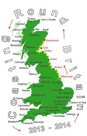
Log No 31. Tue 30th Apr 2013 - Stonehaven to Aberdeen, 19 miles (510 miles walked)
This would be my last day & night based at Fiona's, after I have reached Aberdeen it will be back to reality, walking with a full pack and not always knowing where I will be camping at the end of the day.The weather was probably the best so far this trip, a lot of blue sky and not quite as cold as it has been.
I got off the bus at Stonehaven at 10.50 and I was expecting it would be late before I get into Aberdeen. I walked along the front for a short while before going inland a bit onto the minor road.
This joined the main road (A90) which was very busy, it was dual carriageway but there was a footpath for me to walk on.
The first time a lorry came by my cap got blown off with the back-draught so I had to remember to hold onto it every time one came by.

| The footpath around Cran Hill from Newtonhill |
I eventually got off the main road at 12.00 when I took a track into Muchalls, a small ex-fishing village.
A footpath (with a Coastal Path sign) out of the village took me past the farm, Mains of Monduff, and into Newtonhill where I had a quick lunch sat on a bench looking over the Burn of Elsick to Cran Hill.

| The coast ahead from Cran Hill |
I wasn't on the actual coast but I don't think I could get very near it anyway as it seemed to be gorse filled slopes above the cliff.
It was very pleasant walking, a mixture of footpath, track and minor roads taking me by the farm at Blackburn, through Downies and into Portlethen Village.
I never saw a sign here and decided to head towards Portlethen and take the first track back to the coast.
When I got to the bay here there was a signpost which looked as though the path could have continued along the coast from the village.
With the map showing two quarries ahead of me on the coast I presumed I would not have access so, at Findon, I stayed on the minor road, which was also the cycleway, into Cove Bay. It was 15.15 and I reckoned I would be in Aberdeen much earlier than I had first thought.

| Caves at Cove Bay |

| Razorbills and Kittiwakes at Cove |
Taking this track under the railway I came out at the cliffs which were noisy with nesting birds, Razorbills & Kittiwakes.
This was a very good footpath, with evidence of fairly recent maintenance, and it followed the cliff with all it's ins and outs..
Apart from 3 climbers on the cliff at Burnbanks Haven I never met anyone else, only a horse in one of the fields of the Rare Breeds Farm at Doonies wanted to keep me company and followed me up to the edge of it's field boundary.

| The footpath and looking to the lighthouse at Girdle Ness |
I rounded Greg Ness then the path came down to Nigg Bay, from here I stayed on the road as it went round the side of the final headland of Girdle Ness and into Aberdeen.

| Aberdeen Harbour |
I got to the bus station at 17.05, making it 6 hours 15 minutes for todays 19 miles, a much more respectable rate of knots.
Apart from the spell alongside the A90 it was an enjoyable day and I had no physical problems.